The PoleOS™ Company
Why Field Technology and Structural Analysis Software are Critical to Broadband Expansion in 2023
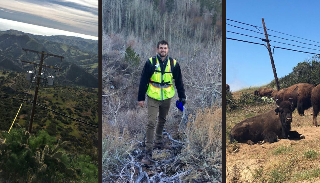
I started fielding poles just after I graduated from college.
It was 2016, a time that would come to be known as the “gold rush” era of broadband network expansion in the US.
Fifth-generation (5G) technology had just been introduced and first-to-market communications companies were eager to survey the poles of the nation’s electrical grid to analyze how the network of the future would attach to existing infrastructure.
As a recent college grad with a geographic information system (GIS) concentration, I had a deep understanding of systems that analyze and display geographically referenced information and the related data attached to a unique location.
It turned out that I was the perfect candidate to join the waves of fielders who traveled the country and captured the data necessary to achieve defendable and dependable pole load analysis for the imminent expansion.
I also loved working outdoors, which made me a perfect fit for the field. Because I often worked on a “piece rate” which allowed me to earn more based on the number of poles I fielded, I earned a good living.

It happens that way when a new market explodes and industry-leading organizations are willing to compete for top fielding talent that can make quick and effective headwinds in a race to be first-to-market.
Fast forward to the end of 2022 and the workforce being hired to assess America’s infrastructure for broadband’s continued expansion looks a lot different than it did just five years ago.
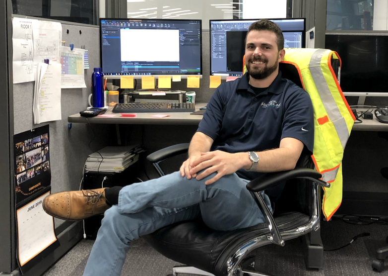
GIS degree-holding fielders like me who broke into the industry during the gold rush era quickly rose through the ranks, ascending to field supervisor positions and ultimately to engineering and product management roles that essentially promoted us out of the field and into the office.
Today, the hiring strategy and training curriculum for entry-level fielders are also a lot different than when I broke in back in 2016.
For one, companies are largely hiring workers without the educational background I had when I joined the fielding workforce, and they are hiring a lot more of them.
Secondly, they are paying lower salaries than was the case in my day–which makes sense, given the lack of knowledge and experience many of the new hires possess.
Lastly, entry-level fielders today are receiving less training than they did when I started my career as a fielder.
Whereas I was trained for about a month before being sent into the field, today’s entry-level fielder tends to only have a few days to a week of training provided.
It’s a numbers game for fielding companies who realize that not all of the hired fielders who are sent through training will last in the industry. Given the urgent demand to assess the grid’s infrastructure, this hiring and strategy has merit.
There simply aren’t enough college graduates with GIS degrees seeking to enter the fielding workforce to account for the amount of fielders the industry needs.
The start-with-a-big-pool-of-workers-and-settle-with-a-smaller-one-through-attrition is by no means unique to the fielding industry. Across the world, workforces are transforming in a similar way for reasons that are too many to cover in this article.
How then, given the nature of the transforming workforce and the still-urgent need to acquire pole data, can fielding companies maintain a level of efficiency and safety for their fielders?
The answer is twofold: easy-to-use technology in the field and superior data and structural analysis tools in the office.
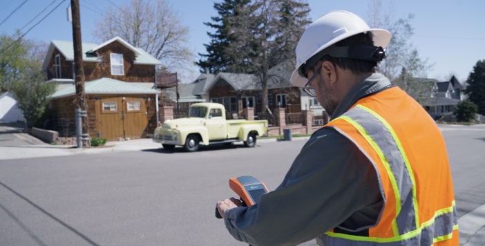
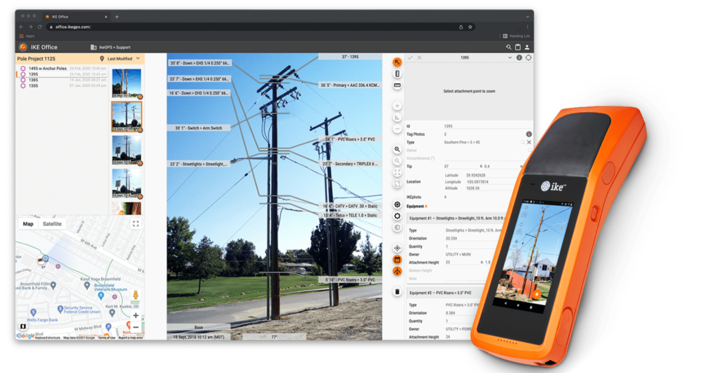
Providing field workers with imaging devices that allow the fielder to capture pole data easily is a boon to field safety because it doesn’t require the fielder to haul around unnecessary weight from traditional gear such as a Hasting Stick.

During my time in the field, I covered a lot of ground with a Hasting Stick in tow. Some of the larger ones can weigh as much as fifty pounds. The heavy load causes fatigue over the course of a workday, which taxes a fielder’s all-important situational awareness and can lead to accidents.
Digital devices eliminate the need for Hasting Sticks and other heavy gear. The fielders need only the device and a tripod to survey the infrastructure and acquire the necessary data.
As a result, both he and his fellow fielders don’t tire as easily and can maintain alertness for the duration of the workday.
Technology also empowers today’s fielder by bridging the skills gap since the fielder doesn’t have to know every component that’s attached to the pole. He need only take the picture and the device and the back office team does the rest of the work.
Gone is the possibility of human error, which can occur with even the most well-trained and experienced fielder if he makes a simple mistake and writes down the wrong information.
Back in the office, engineering analysts that have cloud access to the data that’s been captured in the field can get started on their pole load analysis or digital twin creation process almost immediately.

That’s because the data that’s been efficiently and safely acquired in the field is fed into the system via the cloud in near-real time, eliminating the need for analysts having to wait for the fielder to physically transfer the data–which can take considerable time if fielders have to travel great distances before they arrive in the office.
The workflow is streamlined, leading to key organizations acquiring actionable insights in a fraction of the time than it takes using less sophisticated technology and software.
Broadband expansion continues in the US at an intense pace. The need for fielders to assess the grid’s infrastructure shows no signs of waning, nor does the need to analyze and understand the acquired data in a quick timeframe.
With the right technology, electric utilities, the engineering firms that serve them, and communications companies seeking to attach to the grid can get the most out of their workforces and attain the necessary analysis to keep the grid running strong for the next generation of technology and people.

About the author:
Spencer Hankin is a Senior GIS Manager for ikeGPS. He has worked in every aspect of OSP aerial engineering including fielding poles in remote areas, building PLAs, managing field teams, and overseeing fiber design projects from start to finish as a lead OSP engineer. He holds an undergraduate degree in Geology from the University of Colorado and an MBA from the University of Redlands with a concentration in Location Analytics.
Explore IKE Office ProThe latest from the IKE Wire
Harnessing Data, Machine Learning, and Predictive Analytics for Storm Resilience
In the world of electric utilities, storm season can bring disruptions from mild to c...
Read MoreFour Steps to Accelerate Broadband Deployments with Pole Data and Analysis
Improve the pole attachment process and connect customers faster The explosion of bro...
Read MoreSlow Permitting Approval Process? There’s a Federal Committee for That.
For communications companies seeking to expand broadband networks to new customers, a...
Read MoreSubscribe to the IKE Wire
Get the latest insights on data acquisition and structural analysis from the ikeGPS experts.


