The PoleOS™ Company


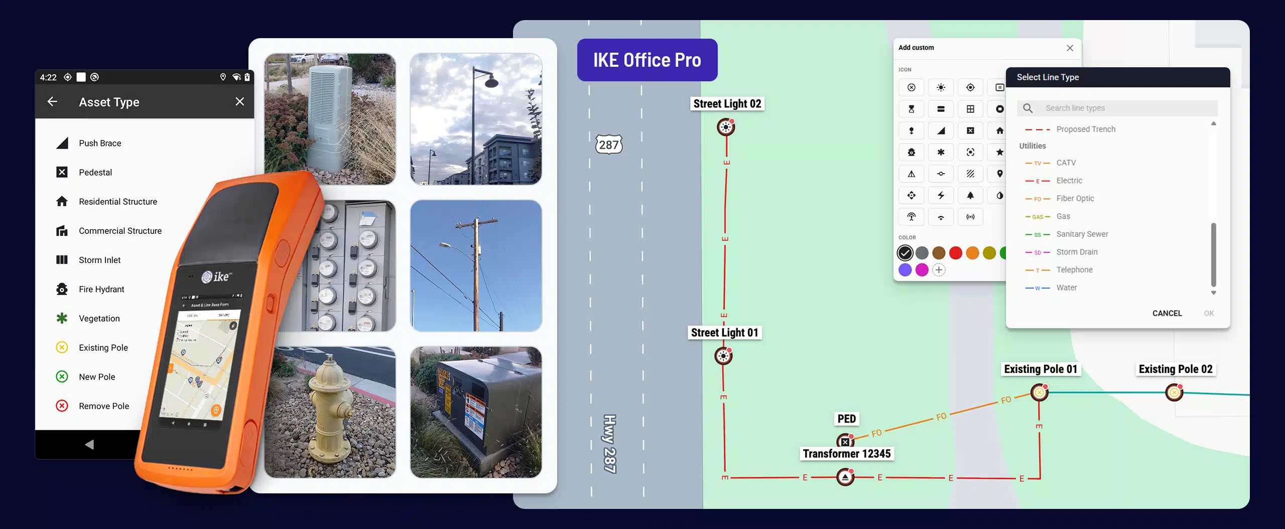

Building new or relocating utility infrastructure requires collecting precise locations of existing assets, capturing ground profiles, laying out proposed locations for construction, and documenting what was built. Traditional methods require multiple crews, each specializing in different tools and documenting different parts of the site.
With IKE, a single field technician with one device covers it all: existing conditions, layout, and as-built, overhead and underground. Capture poles, equipment, lines, ground profiles, and surrounding features and assets, then seamlessly send the data to downstream systems.
Get GIS records that match the real world
Capture precise locations and enable a single source of truth for field data.
- Feed precise locations of assets - designed and as-built - back into GIS
- Bring contractor data into your shared system of record
- Cut site visits and field-office handoffs to speed construction

Standardize on one device from survey to as-built
Make the most of a single field visit by collecting precise locations, as well as other relevant data points.
- One collection form covers poles, lines, underground assets, ground profiles, and surrounding features like curbs, crossings, and other utilities
- Field crews and design teams learn one tool and can be assigned to field data collection, survey and staking, or as-built inspections
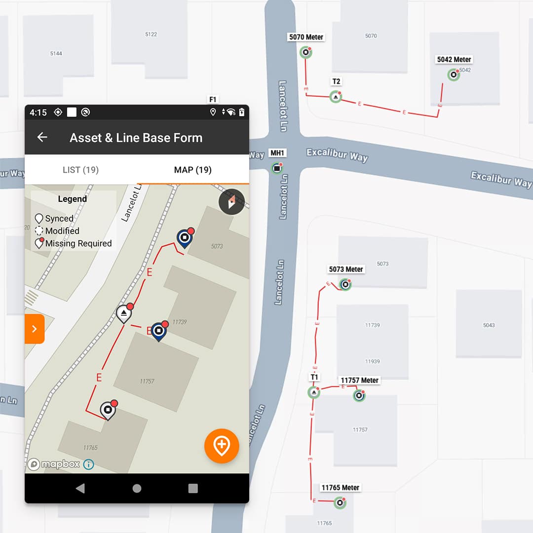
IKE’s field staking solutions
IKE’s field and back-office tools capture and lay out precise asset data, then connect it to the systems that design, analyze, and estimate the work.

IKE Device
The single source of truth for overhead and underground asset and project data, across field and office teams.
- Capture precise RTK locations for poles, pad-mount transformers, pedestals, meters, vaults, manholes, risers, streetlights, and more
- Capture ground profiles for clearance checks and sag analysis for pole loading analysis and design
- Navigate to imported or planned points to set stakes without a total station crew

IKE Office Pro
Build accurate as-built and make-ready models with our industry-leading pole loading analysis software.
- Place proposed poles and assets on the map, or import GIS, CSV, or Excel coordinates
- Give field, back office, utility, and contractor teams authorized access to the same records
- Export data to GIS, CAD, design, and pole loading tools
Learn More

IKE PoleForeman
Build accurate as-built and make-ready models with our industry-leading pole loading analysis software.
- Analyze existing and proposed conditions against utility standards and National Electrical Safety Code® (NESC®) compliance, including clearance, strength, and separation requirements
- Standardizes PLA operations with third parties
Related Resources
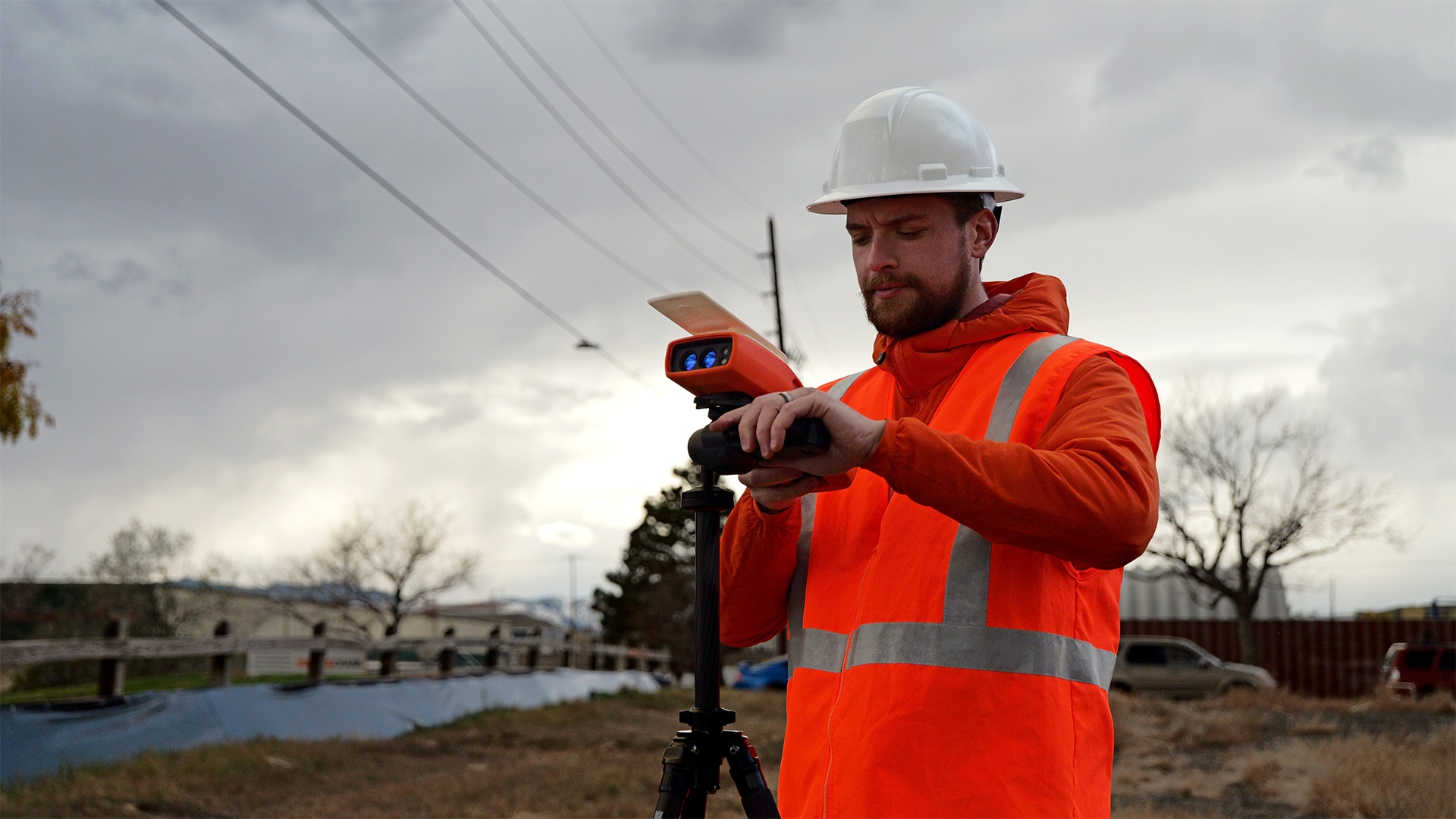
The IKE Device now supports staking and a lot more utility fielding workflows
The latest round of IKE Device updates expands the scope of what a single field data collection visit can deliver. Collectively, they support improved utility...
Read Now
Overhead, underground, same job. Why two tools?
One person. One device. Start to finish. Most field jobs don’t fit in one tool. Staking a new subdivision, a highway move, a line that...
Watch Now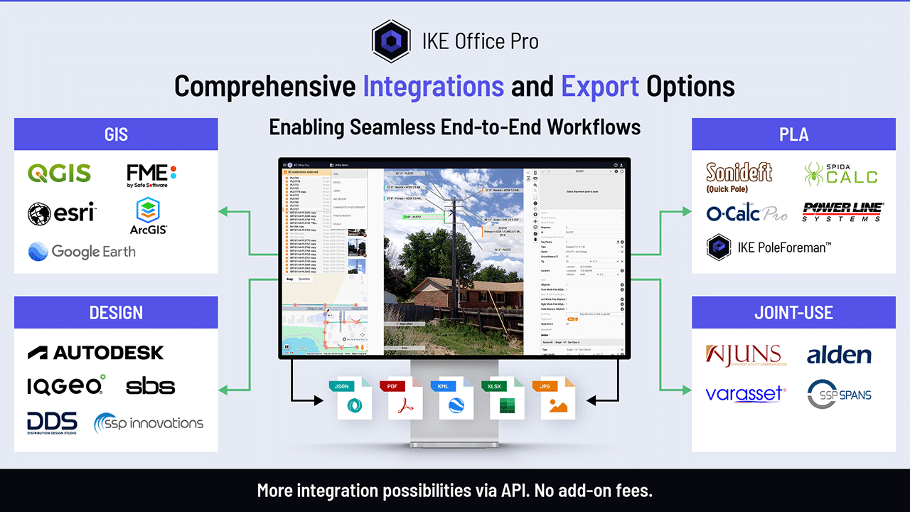
IKE Office Pro’s integrations and exports get your pole data where it needs to go
With robust integrations, APIs, and a wide range of export and reporting features, your pole data can go where you need it—whether it’s to GIS,...
Read NowFAQs
What does IKE mean by field staking?
Capturing precise locations of existing assets, laying out proposed locations for construction, and documenting what was built. IKE does this for overhead and underground work with one IKE+ Device, combined with IKE Office Pro for data management and back-office analysis.

What is RTK positioning, and why is it important?
Real-Time Kinematic (RTK) positioning is a satellite navigation technique that boosts standard GPS and GNSS accuracy from 2 to 4 meters down to just 1 to 2 centimeters in real time. This precision is essential for accurate mapping of utility and communications infrastructure.
Does IKE Office Pro estimate construction units, materials, or costs?
No. IKE captures and lays out the locations, then hands the data to the staking, work order, or design systems.
Can I capture overhead and underground in the same job?
Yes. One field data collection form covers poles, equipment, underground assets, lines, ground profiles, and surrounding features. A technician can go from a pole to a riser to a buried service without changing forms or tools.
Can I plan a job before crews go out?
Yes. Place proposed poles and assets on the satellite map in IKE Office Pro, draw lines, or import GIS, CSV, or Excel coordinates. Fielders then navigate to each point to verify and stake it.
How does staking data get into our GIS and other systems?
IKE Office Pro exports points, lines, and vector data as shapefile, KML, JSON, and CSV, with datum conversion to your standard. The IKE Office Pro API supports direct connections. Crews can also get a multi-page PDF map package.
What do I need to use the new staking tools?
An active IKE Office Pro subscription and a 3600 series IKE Device. If you have an older device, contact us about upgrade options.