The PoleOS™ Company


Common field staking errors (and how to avoid them)
Errors made in the field when staking or surveying utility lines may look small on a staking sheet. By the time it reaches construction, it can mean a pole that won’t fit, a span that violates clearance, or a crew sent back out.
NRECA’s staking manual describes staking as selecting the poles, conductors, pole-top assemblies, guys, and anchors for a line, then placing stakes to mark where each structure goes. Catching a problem during staking costs at most a return visit. Catching it after equipment is ordered, permits are filed, or a crew is on site costs a lot more.
Below are the seven errors we commonly see with the field staking and surveying process, why they happen, and how to prevent them.
The seven errors
1. Trusting the map
What goes wrong:
The job starts from GIS coordinates that were never verified in the field. Many utility maps were digitized from paper, stretched to line up, or placed by eye from aerial photos. Small errors compound along a line, so the further from the starting point, the further the map drifts from reality.
What it costs:
Location errors cascade down the line. Fielders also waste time hunting for the right first pole.
How to avoid it:
Treat existing records as a starting point, not the truth. Preload them into the job, navigate to each point in the field, and confirm or correct the location before design begins. With the IKE Device, a fielder selects a point on the map and gets a live compass heading, distance remaining, and current GPS accuracy, then updates the record on the spot so the corrected location flows back to the office.
2. Estimating distances and span lengths
What goes wrong:
Span lengths get paced off, scaled from a map, or eyeballed from a photo.
What it costs:
Span length drives clearance and pole loading calculations. An error caught late usually means a revisit and a redesign. On underground work, a bad distance means the wrong amount of cable and the wrong count of vaults or junction boxes on the material order.
How to avoid it:
Measure, don’t estimate. On the IKE Device, tap two points on the map to get the straight-line distance and bearing instantly. For underground runs, walk the route with the IKE Device’s line tool and let the device record the path, so the length comes from the field instead of a guess.
3. Using GPS that isn’t accurate enough
What goes wrong:
Teams capture locations with a phone, tablet, or basic Bluetooth GPS puck.
What it costs:
Low-accuracy points end up in the design and the GIS, and the error isn’t obvious until someone in the field can’t find what the map says is there.
How to avoid it:
Match the tool to the job. Total stations deliver millimeter-level accuracy, but they’re expensive, slow to set up, and often need a two-person crew. For most distribution and communications work, RTK-grade GPS is the right fit. IKE Device customers using RTK get high-accuracy positioning built in, without a separate base station, rover, and subscription. Whatever you use, check the accuracy reading before you mark a point.
4. Missing surrounding objects
What goes wrong:
The fielder captures poles but misses streetlights, curbs, vaults, and buried services for traffic signals, which could impact design.
What it costs:
Designers working from the office can’t see conflicts they don’t know about. Constructability problems surface when the crew arrives, and overhead-to-underground transitions get drawn from memory.
How to avoid it:
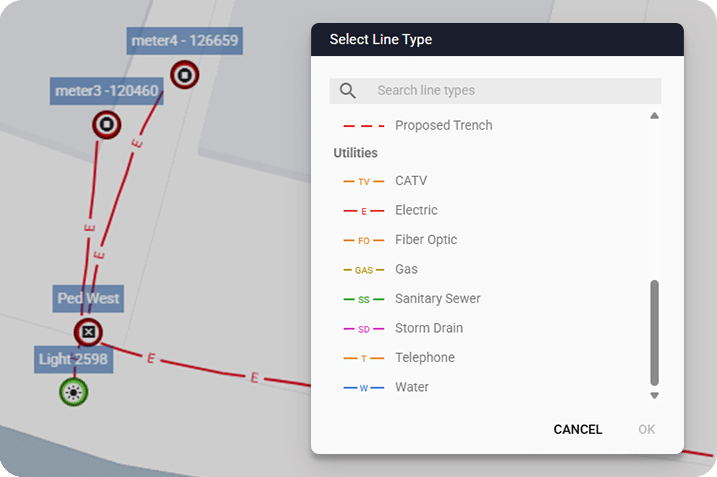
Capture the whole site, overhead and underground, existing and proposed. The IKE Device records vaults, manholes, junction boxes, streetlights, buildings, curbs, sidewalks, and road centerlines in the same collection form used for overhead work, with custom symbols for anything else. The line tool captures running lines as the fielder walks them, recording a point at a set distance (as often as every three feet), a set time, or manually. Proposed assets get marked with the same tools, so designers see existing and new side by side.
5. Guessing the terrain
What goes wrong:
Grade under a span, across a driveway, or at a road crossing gets estimated from a photo, or assumed flat between two poles.
What it costs:
Terrain feeds sag calculations, pole loading analysis, and clearance checks. A missed low spot or ditch can put a design out of clearance. Highway and railroad crossings usually need a profile of road elevation against proposed wire height for the permit, and a missing profile means another trip.
How to avoid it:
Capture the ground profile while you’re already on site. The IKE Device’s ground profile tool with built-in RTK positioning records elevation point by point as the technician walks the path, either continuously or at the specific high and low points that matter. The midspan tool captures conditions between poles.
6. Losing the stakes mid-project
What goes wrong:
In many construction projects, the stakes go in early and the site changes fast. A grader scrapes the right-of-way, and the stakes are gone.
What it costs:
Without stored, accurate locations, the team has to re-survey and re-stake, often with the same total station setup and crew as the first time.
How to avoid it:
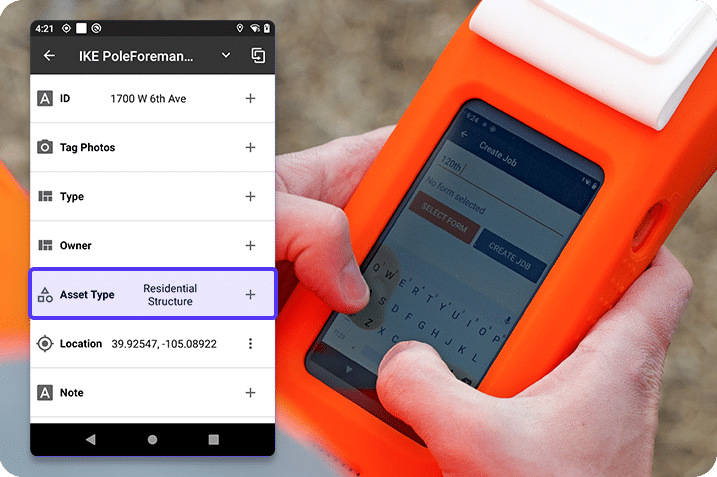
Keep every staked location in the job, not just in the ground. When stakes disappear, a fielder can navigate back to the stored points with the IKE Device and re-mark them without re-surveying the whole job.
7. Treating the as-built as a separate job
What goes wrong:
Staking data lives in one tool, the design in another, and the as-built gets captured later, if at all. In some organizations, GIS staff still hand-post CAD files into the system.
What it costs:
Records differ from reality. Utilities assume assets were built exactly where they were staked, which may not be true. Underground is the hardest case: you can see where an overhead line runs, but between the vault and the transformer, the record is all you have.
How to avoid it:
Use the same data from field survey through post-construction. Locations captured while staking can be compared to the as-built record once construction is completed, and the confirmed coordinates go into the utility’s GIS without a separate as-built survey. IKE Office Pro keeps field data in one place for every authorized party and exports it where it needs to go: shapefiles for GIS, CSV and Excel for design and estimating tools, and JSON or API access for custom integrations.
Why small field staking errors get expensive
A field staking error moves downstream into every step that relies on the data:
- Design is built on the wrong numbers, so pole loading, clearance, and sag calculations are off.
- Permitting and joint-use applications go out with incorrect information and come back for rework.
- Material orders include the wrong length of wire, pole class, height, or missing hardware.
- Construction crews find the mismatch on site, stop, and wait for a redesign or a return survey.
Get it right in the field
Most of these errors share a root cause. The field survey didn’t capture enough accurate data, or the data didn’t reach the office intact.
The fix is the same at every stage: get accurate, complete, verifiable data the first time, and keep it attached to the pole record. Better tools and better habits help you do just that.
| Error | The IKE fix |
|---|---|
| Trusting the map | Navigate to and verify every starting point |
| Estimating distances | Measure point to point; walk the running line |
| Low-accuracy GPS | Use RTK-grade positioning and check accuracy before marking |
| Staking only the pole | Capture overhead, underground, and nearby assets in one form |
| Guessing the terrain | Record a ground profile on the same visit |
| Losing the stakes | Store every location so stakes can be re-marked |
| Separate as-built | Reuse staking data to confirm the as-built record |
This applies across the industry. Utilities get GIS records that match the field. Telecom providers capture poles, conduit, and crossings for fiber builds in one pass. Engineering firms put more workflows on every device and fielder, and deliver data that clients can use without rework.
Did you know your IKE Device can now help avoid all seven errors? Request a demo to see the latest field staking and underground capabilities.
The latest from the IKE Wire
IKE Q3 2026 product updates
Over the last quarter, we added even more efficiencies to your field-to-finish workfl...
Read MoreNESC requirements for fiber-optic cables in the supply space
As a member of National Electrical Safety Code (NESC) committees and IKE’s NESC tra...
Read MoreHow to choose the right OSP data collection solution
Comparing five OSP field technologies and the common use cases they support When it c...
Read MoreSubscribe to the IKE Wire
Get the latest insights on data acquisition and structural analysis from the ikeGPS experts.