The PoleOS™ Company



Capture complete pole data in a single visit
Solo fielder, better tools, safer captures – digital processes that boost your field collection efficiency.
Risky collection, expensive revisits
Manual measurements and hot sticks cause risk and delays, and often result in incomplete data and costly revisits.

Field crews take calibrated photos of full poles in minutes

Capture data from a safe distance, without hot sticks or exposure to live wires

Custom forms and required fields ensure complete collections before fielders leave the site
Everything crews need in the field
IKE Device
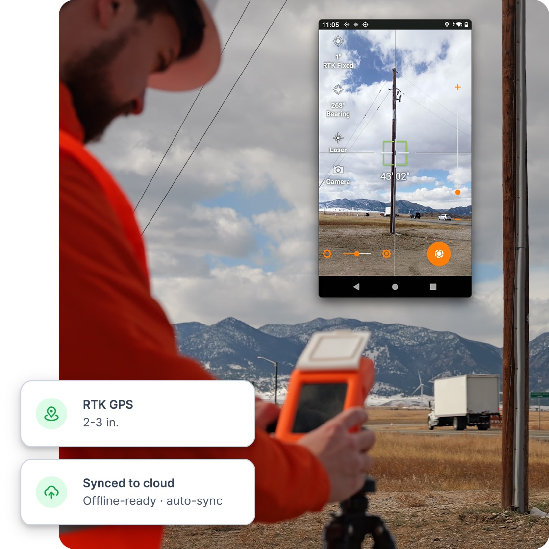
The IKE Device replaces 4–5 separate tools (camera, GPS, rangefinder, clipboard, and forms) enabling single-operator pole data collection. Its laser-calibrated camera captures photos that back-office teams can measure with engineering-grade accuracy.

Custom deliverables & checks
Build forms that match your exact project requirements. Mandatory fields ensure crews capture all required data before leaving the pole, and predefined dropdown menus ensure data consistency.
- Pole audits: Collect specifications, tag IDs, condition assessments, and owner information
- Make-ready assessments: Capture proposed attachments, clearance requirements, and construction notes
- Joint-use inspections: Document existing attachments by owner and flag unauthorized equipment
Our support team assists with form design to ensure you capture exactly what you need for downstream work.

Pre-populated routes & work plans
Load existing GIS and asset data directly onto field devices before crews head out. Fielders arrive at each pole with context about what’s expected, making it easier to spot discrepancies and capture complete information.
- Import pole locations from GIS or asset management systems
- Optimize collection sequences for efficient routing
- Update records from the field (data roundtrip)
- Flag new or missing poles

Offline capability & sync
Complete data collection without connectivity. IKE Office Pro works fully offline, automatically syncing when the connection is restored. Data integrity verification ensures nothing is lost, and the system supports simultaneous fielders collecting the same job or line of poles.
- Crews can sync with Wi-Fi onsite so the back-office team can quickly review and identify any items to recollect and reassign poles before field crews leave the site.
- Dashboards are updated as soon as data is received and provide visibility for planning the next day’s work.

Safety benefits
Photo-based collection dramatically reduces field personnel’s exposure to danger by eliminating time-consuming and unsafe hot stick measurements, enabling data capture from a safe distance (over 100 feet).
- Avoid: Standing in traffic at roadside poles
- Avoid: Live wires and electrical hazards
- Avoid: Dense vegetation and animal encounters
By separating measurement from data collection and moving it to the office, IKE transforms hazardous utility work into safe, controlled activity.

RTK positioning

Standard GPS provides 3–6-foot accuracy, sufficient for basic asset tracking.
Accuracy: 3–6 feet
Best for: Asset inventory, general mapping

RTK positioning delivers 2–3-inch accuracy for engineering applications like pole loading analysis, make-ready engineering, and high-precision GIS integration.
Accuracy: 2–3 inches
Best for: Engineering design, structural analysis
Who uses field data collection tools


Your questions answered
Can’t find the answer you’re looking for? Please chat with our friendly team.
The IKE Device captures calibrated photographs (typically 4–6 per pole), GPS coordinates (standard or RTK), pole specifications (height, class, species, tag ID, condition), and custom project data via configurable forms. The photos enable back-office measurement of all attachment heights, separations, and equipment details within IKE Office Pro—field crews don't measure these with hot sticks.
IKE Devices operate fully offline. All data collection, photo capture, and GPS recording can be completed without connectivity. Data uploads automatically when connection is restored, or crews can manually sync while in the field using a wifi hotspot. Most organizations have crews sync at end-of-day when they return to the office.
Yes. Create unique forms for each project type with custom fields, required/optional designations, dropdown menus, conditional logic, and validation rules. Our support team assists with form design during onboarding and can help add new forms as needs evolve.
Yes. Multiple fielders can work on the same project simultaneously, and the system handles coordination seamlessly. You can assign specific poles to individual fielders in advance, or crews can work the same route by leapfrogging over each other. Data is automatically aggregated from multiple devices when they are synced.
Most technicians are productive after 2–4 hours of training. The workflow is intuitive: navigate to pole, complete form, capture photos, move to next pole. We provide training through IKE University online courses, on-site sessions, and ongoing support.
IKE Office Pro workflow
See field capture in action
Book a walkthrough and watch one technician collect a complete, validated pole record in a single visit.